Summary
- Start
Chubu Centrair International Airport or Nagoya Station - Finish
Chubu Centrair International Airport or Nagoya Station - Mileage
Total 600km
200km per day - Travel Pace
Fast - Onsen Stay
Max. 2 nights - Recommended Seasons
All year round
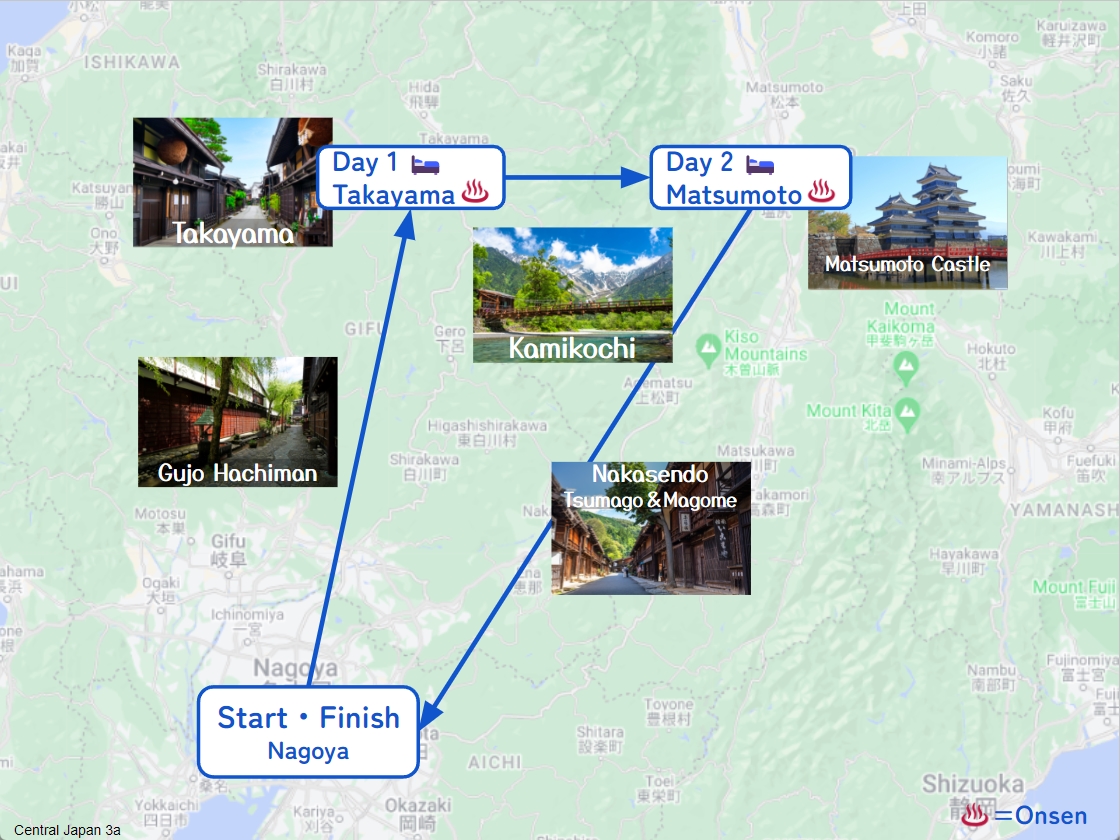
This itinerary takes 3 days to circle around the central Japan area.
Due to the very long daily mileage and, by staying consecutive nights in 1 city only, the travel pace is very fast.
It doesn’t include Shirakawago and Tateyama Kurobe Alpine route. If possible, we highly recommend you add 1-2 additional nights.
Nagoya – Takayama(Sample)
Start: Nagoya (名古屋)
Finish: Takayama (高山)
Mileage:220km
Travel Pace: Fast
On this day you will head from Nagoya to Takayama.
1
Inn in Nagoya
Parking MAPCODE:
9:00
Today’s mileage is long about 220km. Please try to shorten the travel time by using expressways as much as possible.
120 min
2
Monet’s Pond
Parking MAPCODE:
289 518 742*24What is MAPCODE?
11:00
First of all, you will go from Nagoya Airport to Mino IC on the expressway for about 100km.
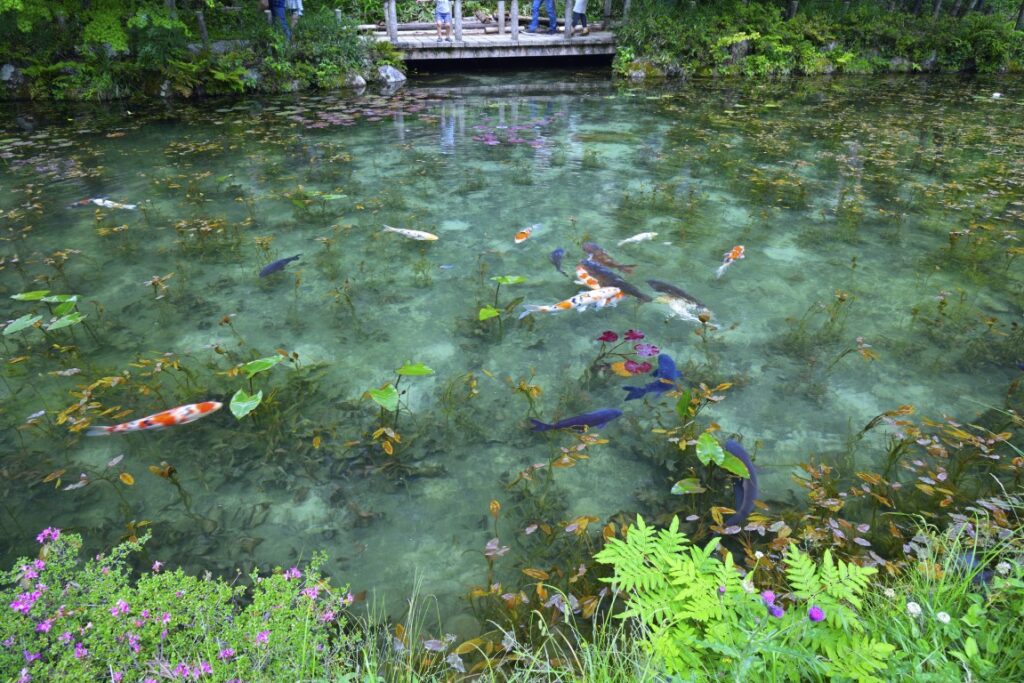
The first destination is [Monet’s Pond]. The water lilies blooming in the highly transparent spring water are very beautiful, and the appearance of Nishikigoi swimming elegantly in the pond is like Monet’s masterpiece “Water Lilies”.
(Note) Nishikigoi is a general term for carp breeds that have been improved for ornamental fish, and is characterized by its colorful body color.
If the weather is bad or if you are traveling in winter, we recommend skipping here to save time.
30 min
3
Gujo Hachiman
Parking MAPCODE:
289 895 728*50What is MAPCODE?
12:30
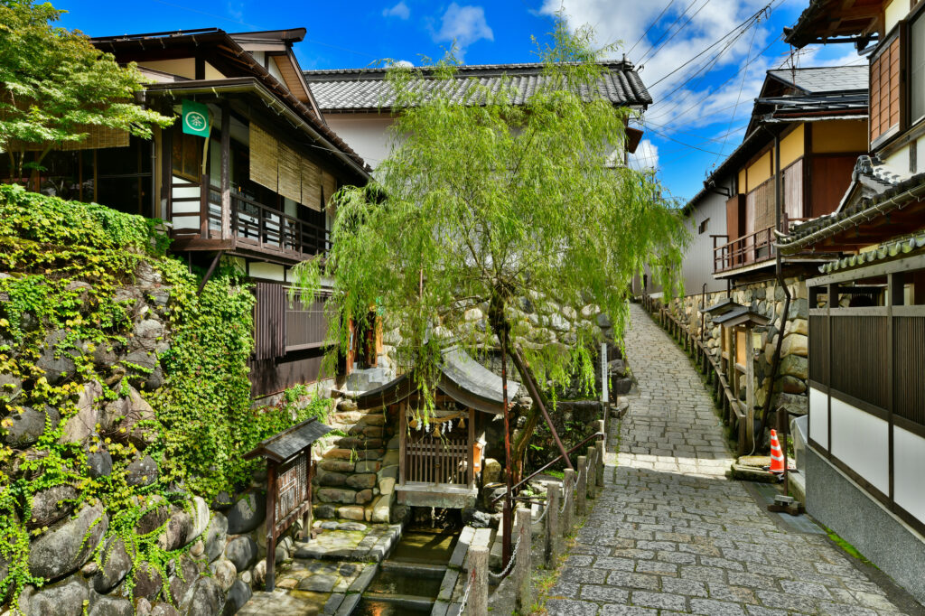
After that, the highlight of the day is [Gujo Hachiman]. Spring waters and waterways spread out in the old townscape designated as an important traditional buildings preservation district of the country, and it has a wonderful atmosphere. There are many attractions such as Sogi-sui, Yanaka-Mizu no Komichi, Igawa Komichi, and Gujo Hachiman Castle, so it is recommended that you spend as much time as possible in Gujo Hachiman.
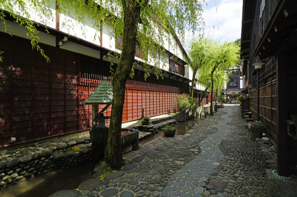
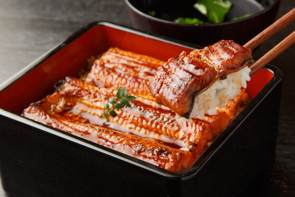
We recommend having an eel lunch at Gujo Hachiman. You can refer to the recommended restaurant on the day-by-day Driving Map
70 min
4
Inn in Takayama
Parking MAPCODE:
Please head to the hotel you reserved.What is MAPCODE?

15:30
On this day, you are staying at [Hida Takayama], the center of the Hida region where you can feel the history and culture. If you book inn near Old town, it is good idea to check-in your inn first.
After checking in at the hotel, please take a leisurely stroll around the old town.
5
Takayama Old Town
Parking MAPCODE:
191 196 559*62What is MAPCODE?
If your inn is located far from old town, please use above MAPCODE.
15:00
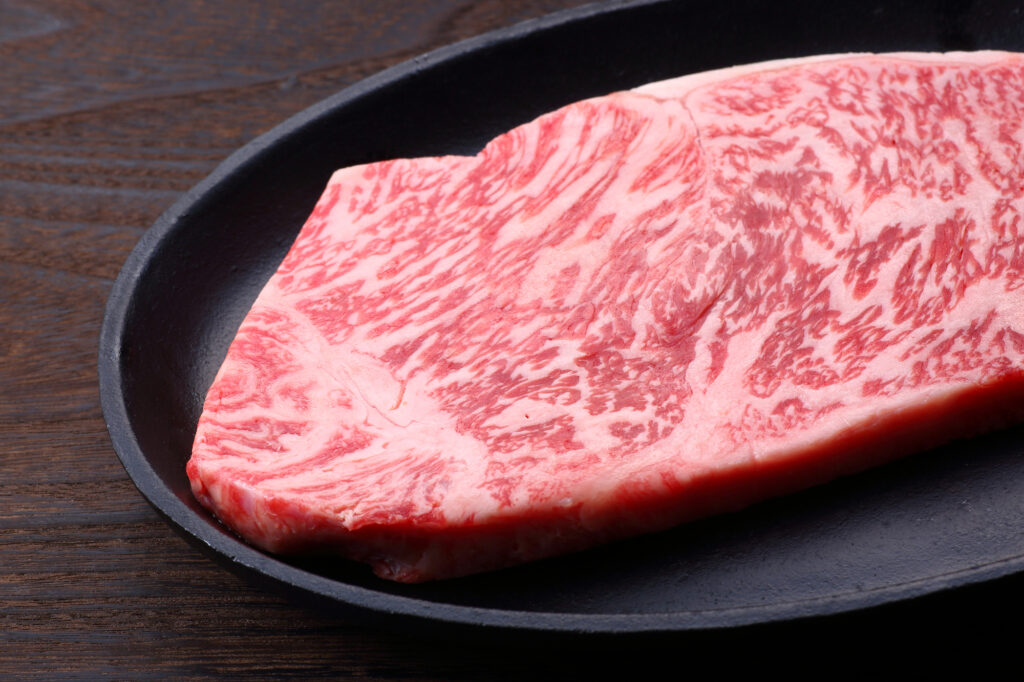
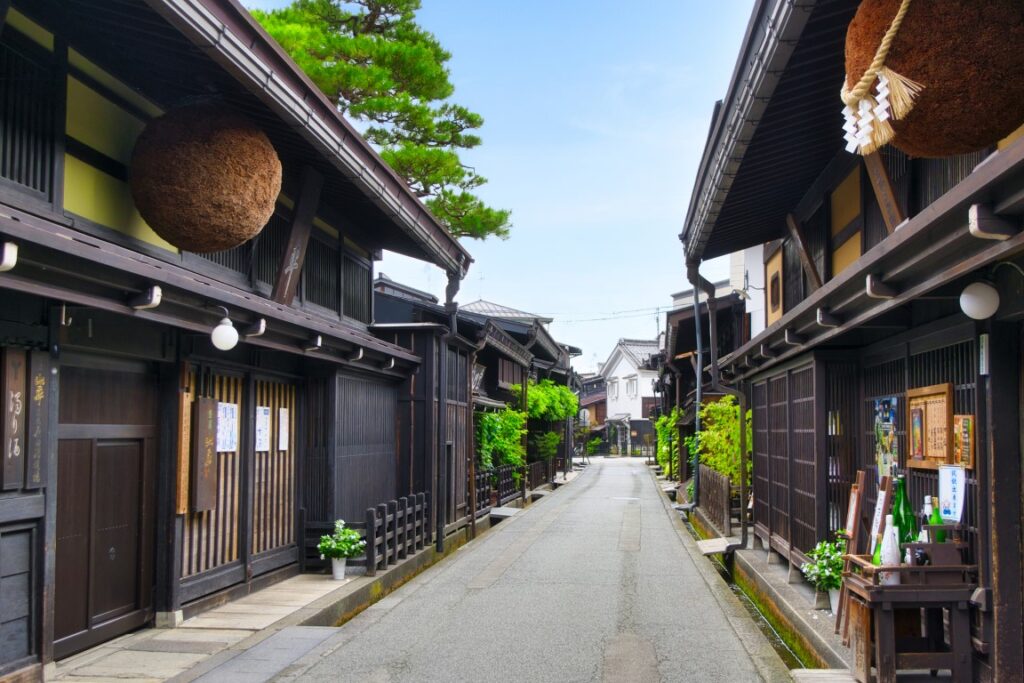
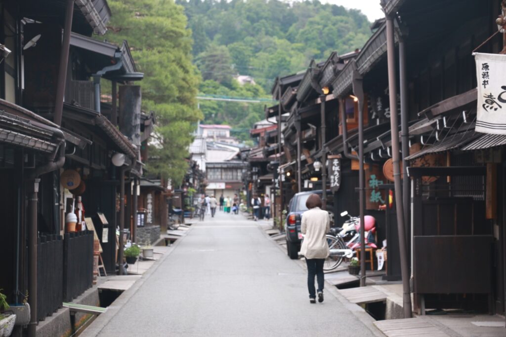
After check-in, enjoy walking in the [Takayama Old Town] called “Little Kyoto”. The appearance of castle towns and commercial towns in the Edo period (1603-1868) is preserved. Shopping while looking at the old cityscape, a tour of the sake brewery, eating Hida beef, minced meat cutlet, pudding, etc. are fun, and time passes in no time.

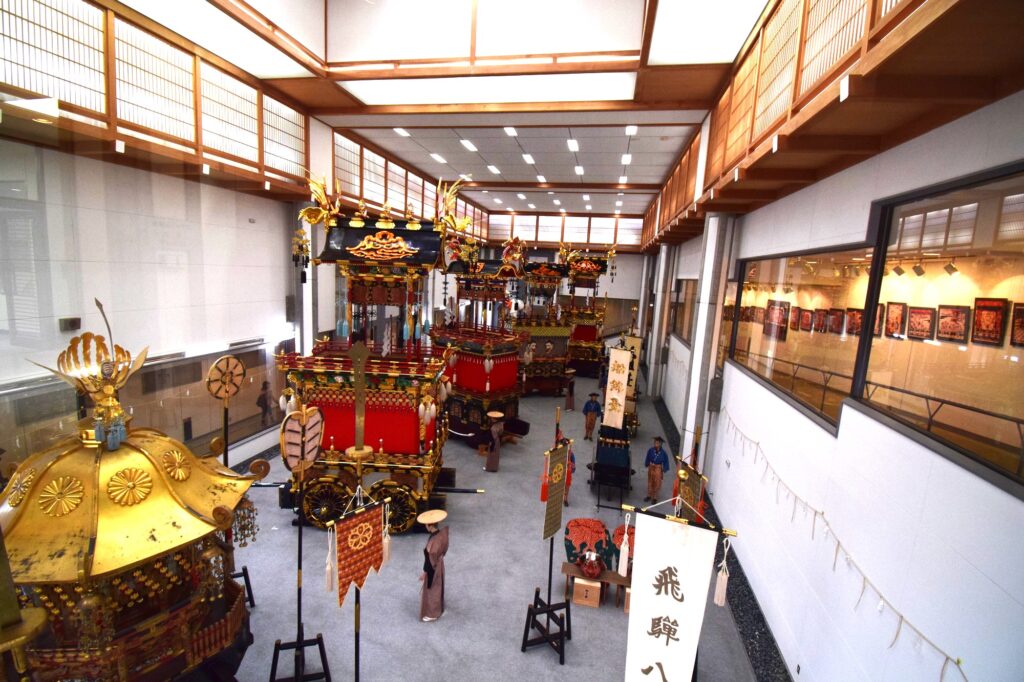
Please drop in at [Takayama Matsuri Yatai Kaikan]. The stalls used at the nationally famous Takayama Festival are always on display.
5 min
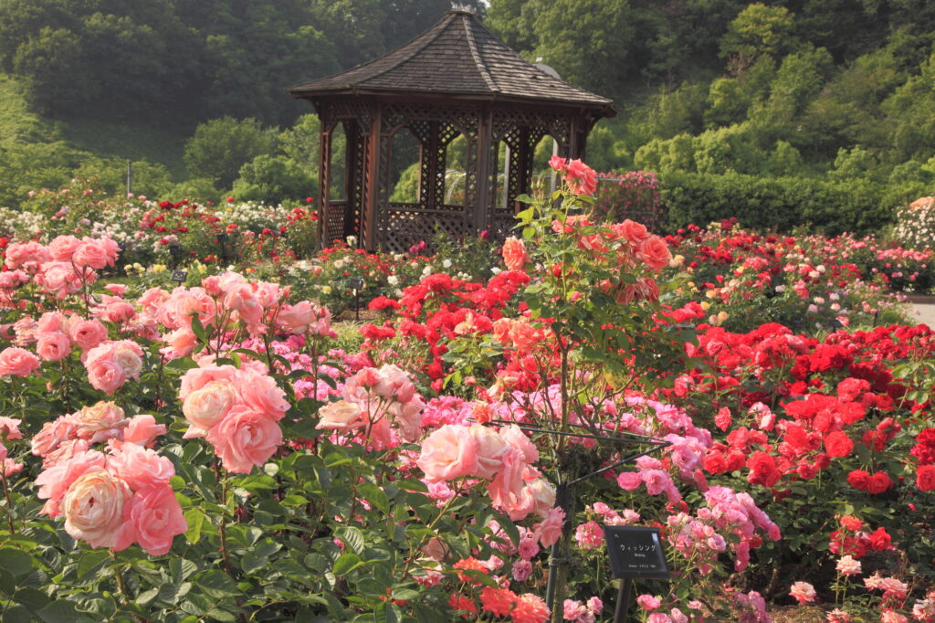
There is one of the world’s largest rose gardens, [Gifu World Rose Garden], on the way to the spot on this day. You can enjoy flowers such as roses, sunflowers, and cosmos all year round. The rose season (mid-May-early June, late October-early November) is especially recommended.
The driving map will show additional 10-20 spots for the day! You will travel only to your favorite spots.
Check pin color and MAPCODE usage.
On this day, you will stay in Takayama(高山) city which is famous for its old townscape.
Many inns are concentrated between Takayama station and Miyagawa river.
- Inn Type
There are a variety of inns like 3-star western-style hotels and 5-star Japanese Ryokans. Please book at your preferred type of inn. - Parking
Luxury Ryokans provides free parking. But middle-range hotels may ask you to park in a nearby public paid parking lot. - Onsen
Many of the inns provide Onsen. However, some western-style hotels don’t have it. - Meal Plan Reservations
There are many restaurants in and around the hotel for dinner, so please make reservations according to your preference.
Takayama – Matsumoto🔒
Start: Takayama (高山)
Finish: Matsumoto (松本)
Mileage:140km
Travel Pace:Relax
You are heading from Takayama to Matsumoto on this day. Enjoy walking in the beautiful Kamikochi highland!
1
Inn in Takayama
Parking MAPCODE:
🔒Book rental car or hotelWhat is MAPCODE?
8:45
The mileage is about 140km, which is short. The highlight of the day is walking in Kamikochi one of the most famous highland in all over Japan.
It is recommended to leave Takayama at 8:45 to catch the 9:50 bus from “Akandana Parking”.
50 min
2
Kamikochi
Parking MAPCODE:
🔒Book rental car or hotelWhat is MAPCODE?
9:35
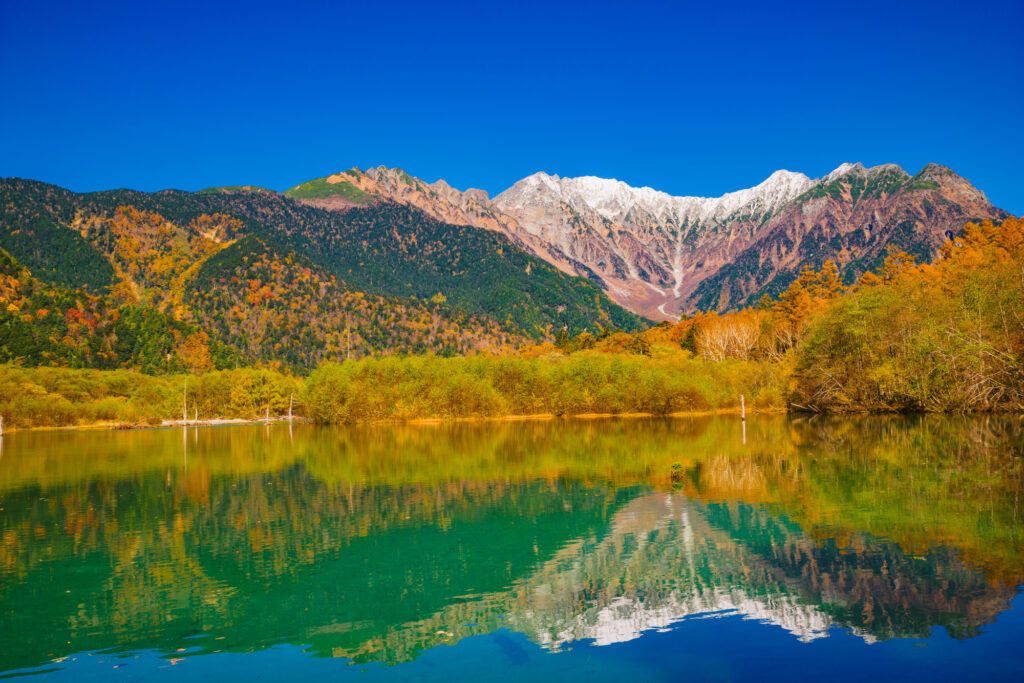
The first is today’s highlight [Kamikochi] highland.
Kamikochi is restricted to private cars throughout the year, so park your car at the “Akandana Parking Lot” and head for it by shuttle bus. Buses depart at 20 and 50 minutes per hour.

The recommended course is to get off at “Taisho Pond” and walk to “Kappa Bridge”. Even children can walk on the road for about 1 hour and half at a slower pace, and you can enjoy the most pleasant walk.
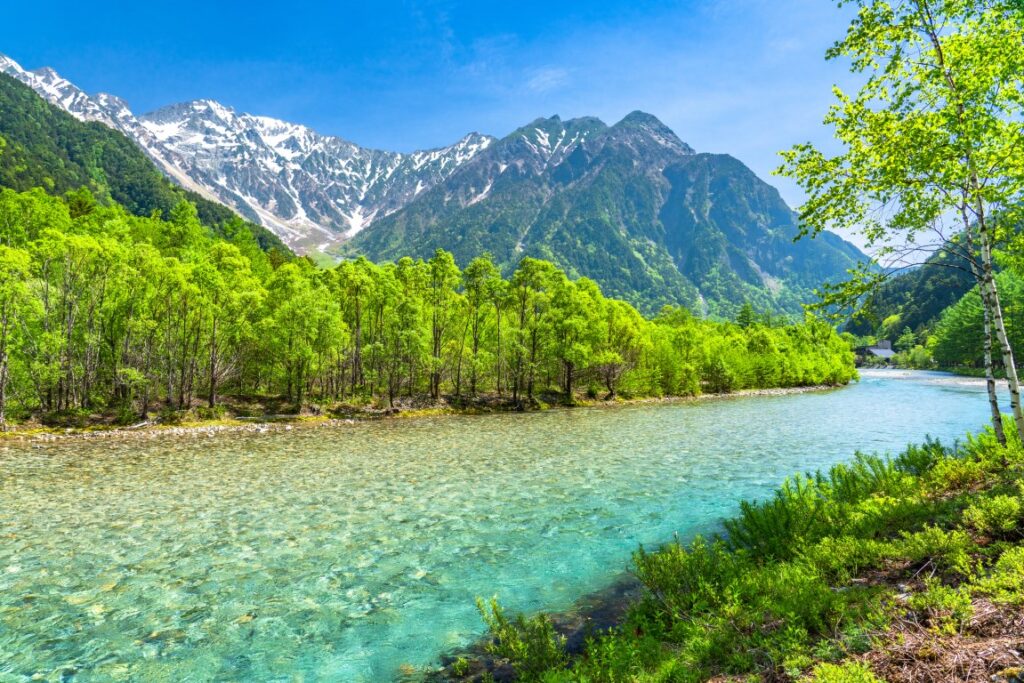

Once you reach Kappa bridge, you can walk 6min to bus terminal. Additionally, there are some restaurants around Kappa bridge and nice for lunch.

Kamikochi is also known for its beautiful autumn colors (Mid-Oct-End October). Please note that it will be closed in winter from Mid-Nov to End-Apr.
30 min
3
Shinhodaka Ropeway
Parking MAPCODE:
🔒Book rental car or hotelWhat is MAPCODE?

13:30
Next, if the weather is nice, head to the [Shinhodaka Ropeway]. Japan’s first two-story gondola is in operation, and you can enjoy a large panorama of the Northern Alps. The autumn leaves season (Mid-Oct-End Oct) is especially recommended.
The ropeway departs at 15 and 45 minutes per hour.
You can check the weather from live camera
100 min
4
Matsumoto Castle
Parking MAPCODE:
🔒Book rental car or hotelWhat is MAPCODE?

16:00
It takes about 50km, 1 hour, and 40 minutes to reach the next Matsumoto city.
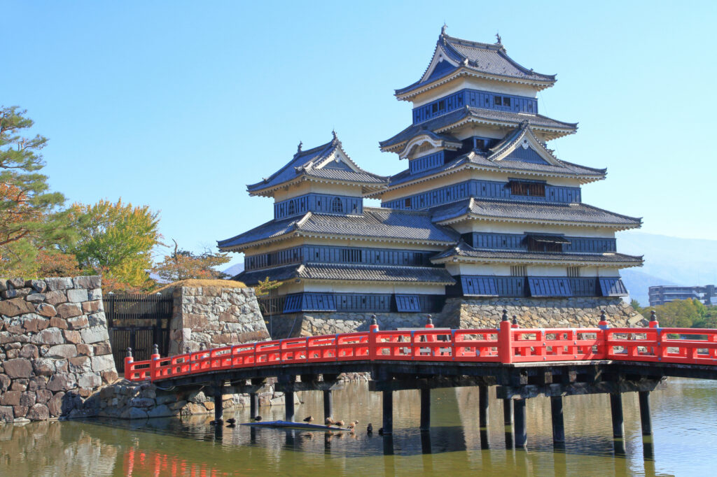
[Matsumoto Castle] is the symbol of Matsumoto and is a national treasure where the original castle tower remains. Known for its beautiful contrast of black and white, the castle has a wonderful landscape against the backdrop of the mountains of the Alps. The last entry is 16:30.
10 min
5
Inn in Matsumoto
Parking MAPCODE:
Please head to the hotel you reserved.What is MAPCODE?
17:00
You are staying at Matsumoto on this day. There are many hotels on the east side of the station, and there are plenty of restaurants.
In addition, Asama Onsen is located just east of Matsumoto City. This is recommended if you want to stay at a hot spring inn.
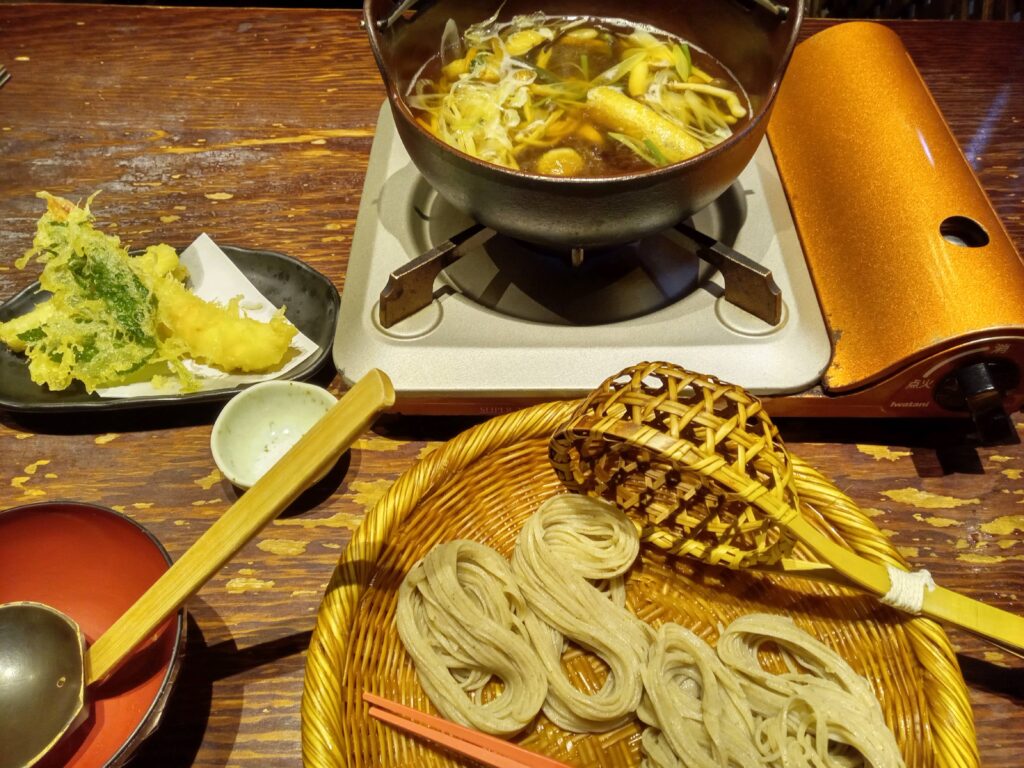
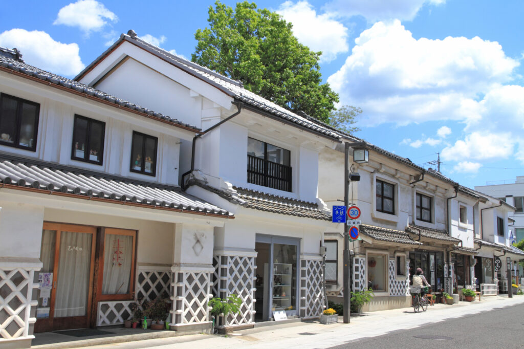
Enjoy local gourmet food such as Toji soba noodles and Sanzoku-yaki (Chicken thigh dish).
If you have time, we recommend taking a walk along Nakamachi-dori road, which is lined with buildings with Namako walls.
The driving map will show additional 10-20 sightseeing spots and local restaurants for the day!
You can travel freely, choosing only the spots you like!
Check pin color and MAPCODE usage.
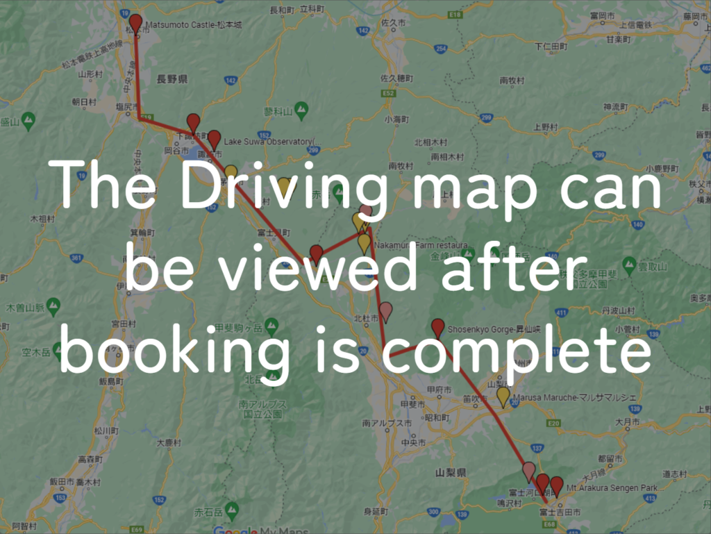
On this day, you will stay in Matsumoto (松本) city.
Many inns are concentrated in the following two areas.
①Around Matsumoto Station
The inns are concentrated east side of Matsumoto Station. This area is convenient for dinner and visiting Matsumoto castle but no inns offer Onsen.
- Inn Type
Most of these inns are 3 to 5-star western-style hotels. - Parking
Most inns have official parking but in addition to the accommodation fee, the parking lot fee will be charged separately. - Onsen
There is no Onsen in this town and no inns have Onsens. - Meal Plan Reservations
As many restaurants are open till midnight, it is recommended to book your inns with breakfast only or without meals.
②Asama Onsen(浅間温泉)
This hot spring resort area is located 4km north of Matsumoto station. If you would like to stay in better accommodation with Onsen, here is recommended.
- Inn Type
Most of these inns are 3 to 5-star Japanese-style Ryokans with Onsen facilities. - Parking
Most inns will offer free parking. - Onsen
This area is famous for Onsen and most of the inns have one. - Meal Plan Reservations
There are few restaurants in this area and be sure to make a reservation with a plan that includes dinner and breakfast.
Matsumoto – Nagoya🔒
Start: Matsumoto (松本)
Finish:Nagoya (名古屋)
Mileage:240km
Travel Pace: Fast
On this day, you will head from Matsumoto to Nagoya along Nakasendo (Route 19), a series of historic post towns.
1
Matsumoto
Parking MAPCODE:
🔒Book rental car or hotelWhat is MAPCODE?
9:00
It is recommended to leave around 8:00 or 9:00 at the latest, as the mileage is quite long at 240km. Also, please use the expressway on the way.
If you haven’t visited Matsumoto castle yet, please visit it before you leave Matsumoto. They open from 8:30.
55min
2
Naraijuku
Parking MAPCODE:
🔒Book rental car or hotelWhat is MAPCODE?

9:55
After leaving Matsumoto, you will drive along the Nakasendo Road and head to Naraijuku which is the Preservation District for Groups of Traditional Buildings. Naraijuku is a place where the townscape of the post town of the Edo period (1603-1868) has been almost completely preserved to this day.
40min
3
Nezame no Toko Gorge
Parking MAPCODE:
🔒Book rental car or hotelWhat is MAPCODE?

11:30
Next, you will visit [Nezame no Toko Gorge], which has been popular as a landmark of Kisoji. The contrast between the white rock surface and the emerald green river flow is wonderful.
40min
4
Tsumagojuku
Parking MAPCODE:
🔒Book rental car or hotelWhat is MAPCODE?

13:15
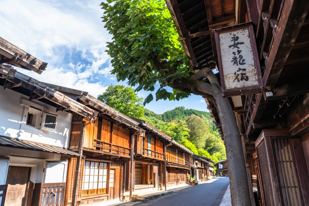
After Nezame no toko Gorge, you will go to [Tsumagojuku] where the vestiges of the Edo period (1603-1868) remain intact. Tsumagojuku was the first post town in Japan to preserve its old townscape, which was designated as an Important Preservation District for Traditional Buildingsand in 1976 for the first time in Japan.
The next post town, Magomejuku, is also popular.
However, since this day is the last day, you may not have enough time. In that case, we recommend skipping Tsumagojuku and then Eihoji Temple.
65min
5
Eihoji Temple
Parking MAPCODE:
🔒Book rental car or hotelWhat is MAPCODE?
15:15
After passing through Magome, you will come to Nakatsugawa City. It is known as the birthplace of chestnut kinton, and there are many Japanese confectionery shops where you can enjoy chestnut kinton and wonderful Mont Blanc.
The distance from Nakatsugawa to Nagoya is about 90km. It takes about 1 hour and 15 minutes on the Chuo Expressway.
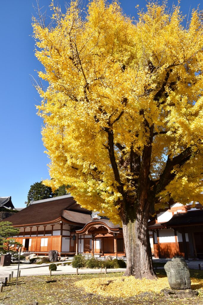
If you have time, please visit Eihoji Temple, which is known for its 700-year-old ginkgo tree. Especially during the fall foliage season, many people flock to see the wonderful scenery of the precincts dyed in yellow and red foliage.
65 min
6
Nagoya
Parking MAPCODE:
Please head to the rental car company branch you booked.What is MAPCODE?
16:30
This concludes your Chubu road trip.
For those who use Chubu Centrair International Airport, please pay attention to the time as the airport is about 45 km from Nagoya Station (center of Nagoya), about 40 minutes away on the highway.
Please use the map codes of the nearest gas stations at Nagoya Station and Chubu International Airport on the drive map.
Nagoya offers a variety of delicious gourmet foods. In particular, hitsumabushi, miso katsu, miso stewed udon, Nagoya cochin, and kishimen are recommended.
The driving map will show additional 10-20 spots for the day! You will travel only to your favorite spots.
Check pin color and MAPCODE usage.

Nagoya is the 3rd biggest city in Japan and the gateway of central Japan travel. Chubu Centrair International Airport and Nagoya station are 50km away and take 45min by expressway. There are hundreds of accommodations around Nagoya Station and the Sakae downtown area.
- Inn Type
Most of these inns are 3 to 5-star western-style hotels. - Parking
Some inns have official parking but in addition to the accommodation fee, the parking lot fee will be charged separately. - Onsen
There is no Onsen in this town and no inns have Onsens. - Meal Plan Reservations
As many restaurants are open till midnight, it is recommended to book your inns with breakfast only or without meals.
Your Perfect Travel Companion!
Our Travel Kit makes your road trip safer and more memorable!
What is DJ Travel Kit?
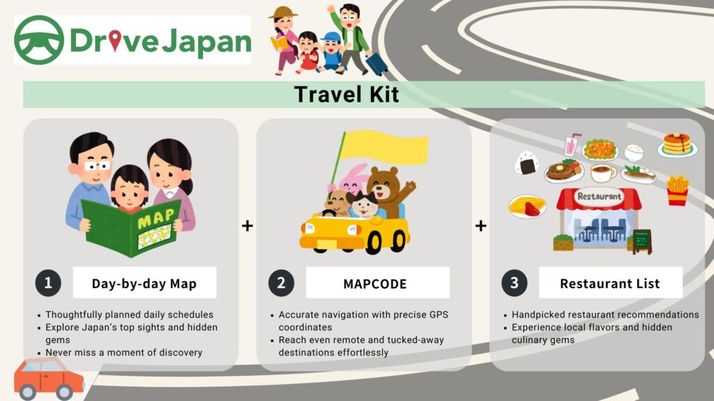
Embark on an unforgettable adventure with our expertly designed travel kit, perfect for uncovering Japan’s hidden treasures! Whether you’re a seasoned traveler or driving in Japan for the first time, this kit guarantees a seamless mix of excitement, culture, and relaxation.
What’s Inside:
Why Choose Our Travel Kit?
Unforgettable Memories: Each day promises unique experiences, from iconic landmarks to hidden treasures off the beaten path, creating memories that will last a lifetime.
Flexibility in Your Itinerary: Our maps are packed with top attractions, hidden gems and eateries along the day’s route. Dive into the places that spark your interest and craft an itinerary that’s uniquely yours. The adventure is in your hands—make it unforgettable!
Stress-Free Travel: With everything you need in one convenient kit, you can focus on enjoying your road trip. Our comprehensive tools and expert tips ensure a smooth and enjoyable experience from start to finish.
Kit 1: Day-by-day Driving Map
Plan your perfect road trip day-by-day with our Google Maps-based driving maps. Each day’s itinerary, such as “Day.1 Tokyo to Hakone,” is packed with curated routes featuring 15-20 sightseeing spots and restaurants along the way, each pinpointed with a MAPCODE(Kit 2).
Sample Day-by-day Driving Map(Tokyo – Hakone)
- Scenic Routes:
We designed for scenic drives, not just the shortest path, ensuring a memorable journey. - Flexibility:
Spend your time only on your preferred tourist spots and dining venues. - Safety First:
Routes are optimized for appropriate driving distances, avoiding risky roads for a secure road trip. - Find Hidden Gems:
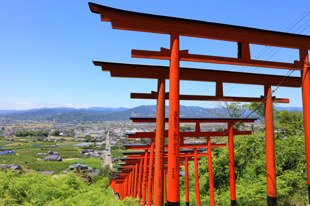
Discover spots Google misses or public transport can’t reach.- Example: Ukiha Inari Shrine
This photogenic shrine is located along the route from Fukuoka to Yufuin, and within 20 minutes you can have the wonderful scenery all to yourself. Few Japanese, let alone foreigners, know about it, and its inconvenient location makes it difficult to visit except by car.
https://maps.app.goo.gl/9ENmDp69E6V7V3B49
Drive Japan day-by-day driving map will introduce you the these hidden gems everyday and make your road trip more wonderful experience!
- Example: Ukiha Inari Shrine
Kit 2: Parking MAPCODE
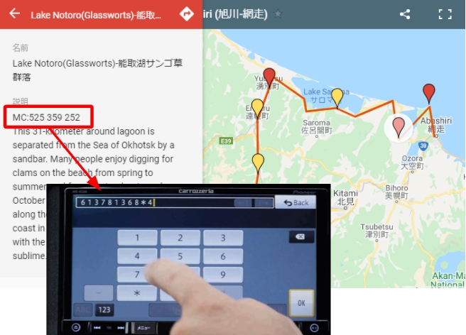
Tired of hunting for parking? Enter MAPCODE instead of addresses in your car’s navigation system! It lead you straight to the most convenient parking at each tourist hotspot, ensuring you spend less time circling and more time adventuring.
- Accurate Navigation:
With MAPCODE, you’re guided straight to the parking spots, not to the middle of a lake or inside a garden! For road trippers visiting 5-6 destinations each day, accurate parking guidance is crucial to make the most of your journey. - Time is Money:
Why waste precious travel time searching for parking or researching routes? International travel is an investment, costing an average of USD 16 per person per hour. For a group of three on a 7-day trip, that’s over 10 hours lost to parking hunts alone. Let MAPCODE streamline your travels, so you can focus on what truly matters—enjoying your adventure!
Kit 3: Restaurant List
Explore curated restaurant lists for each town you stay in, featuring recommended dining options.
Sample Restaurant List(Asahikawa)
- Local Cuisine:
Taste regional specialties and must-try dishes at our handpicked spots. We do not accept advertising fees from restaurants. Our selected restaurants are chosen solely based on their appeal and our firsthand experience. - Convenience:
Easily access Google Maps links for each restaurant, allowing quick checks on photos and operating hours. - Practical Advice:
Provides things you should know about dinner in the town you’re staying in, such as “towns with few restaurants” and “towns with very fast last orders by ordinance.”
Car Booking
Rental Car Booking
Please rent a car with below “Rentalcars.com” link.
- The abundant number of rental cars
- Price comparisons with several major car rental companies
- Free cancellation

Pick-up & Drop-off Location Guide
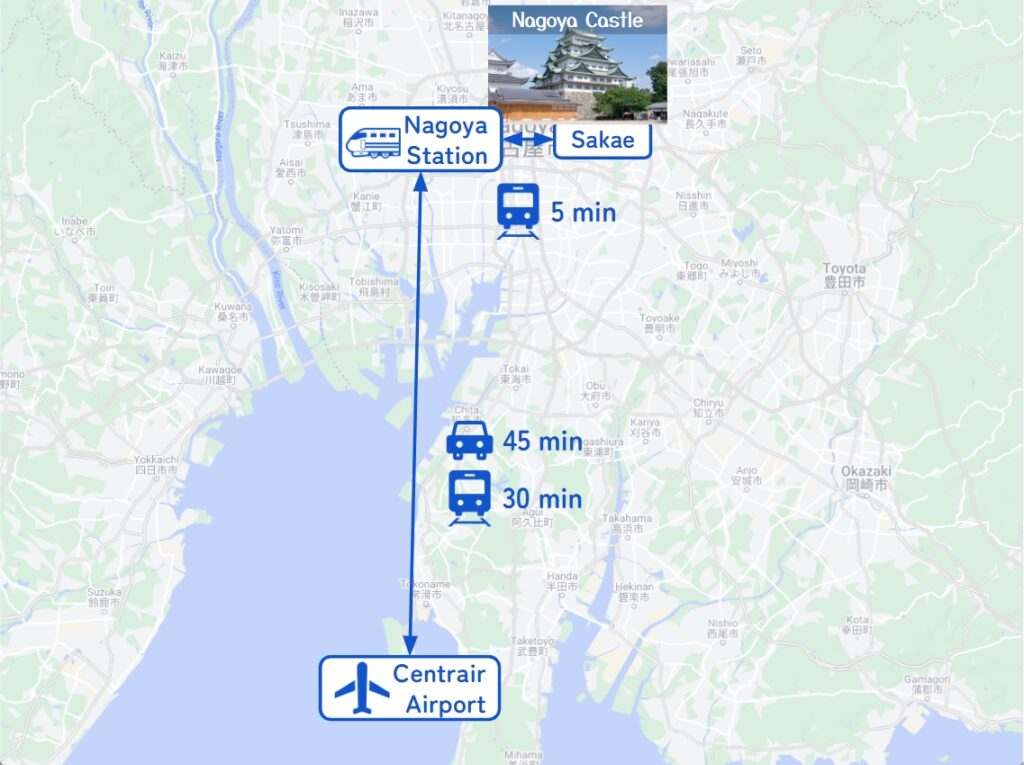
- Chubu Centrair International Airport
The main international airport in Central Japan. Recommended for Pick-up.
If you arrive after 13:00, consider staying overnight around the airport or in Nagoya and departing the next morning.
It takes 30-60 min to Nagoya station by train and 45 min by car. - Nagoya City
The capital of Aichi Prefecture and the 3rd biggest city in Japan. Most car rental shops are located around Nagoya Station.
Nagoya Station, a Shinkansen stop, and downtown Sakae Station are only 5 min by train.
Important reminder for renting a car
- GPS(Car Navigation System)
MAPCODE from Drive Japan navigates you precisely to the parking lot. GPS from major car rental companies(Nippon, ORIX, Nissan, Times) are always MAPCODE compatible. However, if you are renting a car from another company, we recommend that you check with the rental company after making a reservation, just to be sure. - One-way Rental
You can rent at Centrair Airport and return to Nagoya Station, and vice versa. Normally, the one-way charge is about JPY5000. - Child Seat
In Japan, the use of a child safety seat or baby seat is mandatory for children under 5 years old.
Be sure to request one from “Extras”. - Snow Tire
If you travel from the end of November to the end of March, you must book a car with snow tires.

